 Sourced,
 Official Park
 Written Offer
 01The National Park
 04Marine Life
 05Diving
 09Manado to Bunaken
 10Where to Stay
 12Best Time to Visit
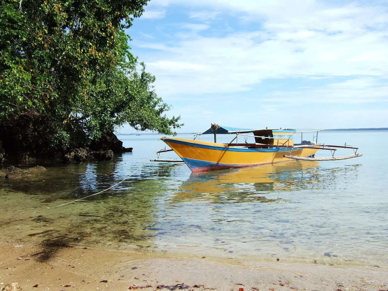
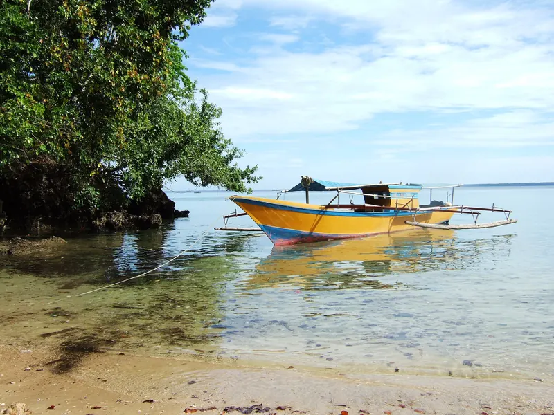 An outrigger boat moored off the beach at Cape Perigi on Bunaken Island.
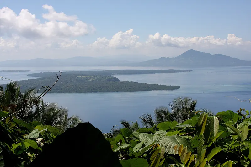 Bunaken Island seen from neighbouring Manado Tua island.
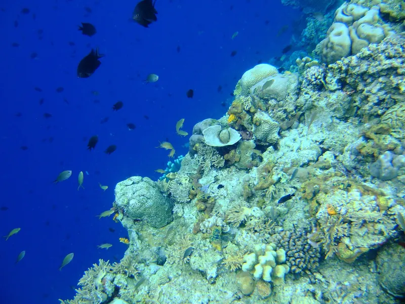 A reef wall meeting open blue water in Bunaken National Marine Park.
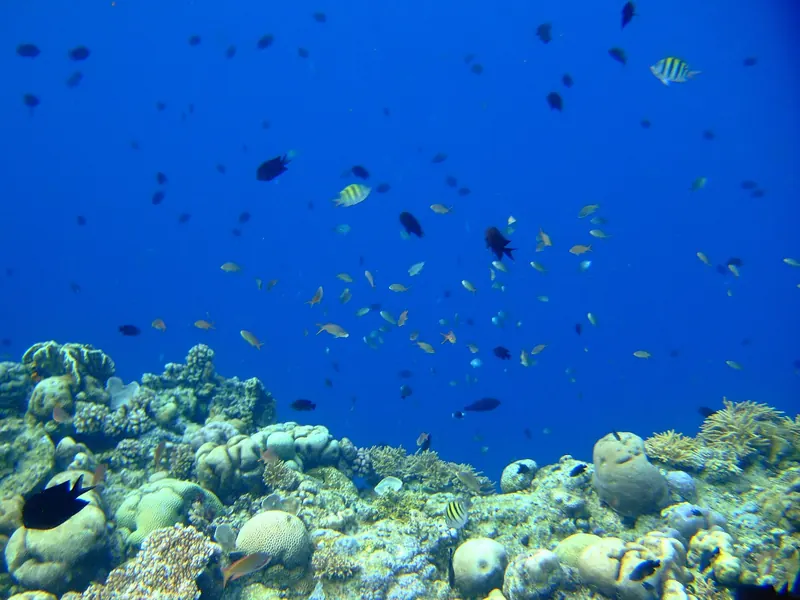 Small reef fish schooling above corals in Bunaken National Marine Park.
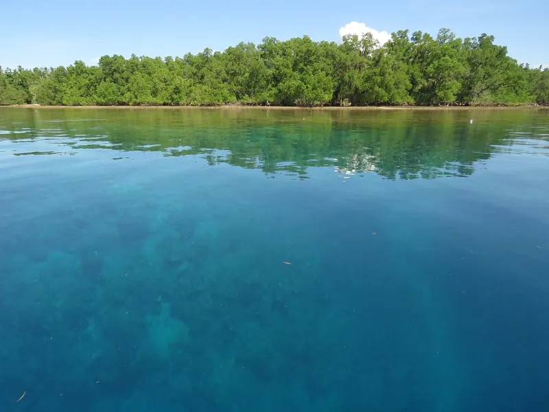 Clear water over shallow reef beside a tree-lined shore at Bunaken.
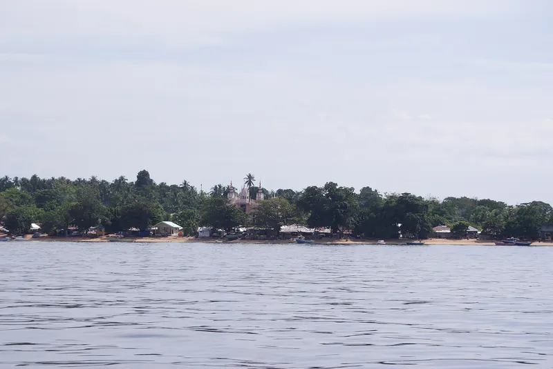 The residential shoreline of Bunaken Island seen from the water.
 Send your question
 Decide in writing
On this page
- What and where is Bunaken Island?
- Why are Bunaken's reefs known for walls?
- Which islands make up the marine park?
- Who lives on Bunaken Island, and what do they speak?
- How do you reach Bunaken from Manado?
- How do you get around Bunaken Island once you land?
- Where can you stay on or near the island?
- When do conditions tend to suit a visit?
- Is there a fee to enter the park?
- What pressures does the reef face?
- Which guide page answers which question?
- What do first-time planners ask about Bunaken Island?
- Which prices are published?
- Which sources support this page?
- How do I reach the desk?
By Bunaken Island Editorial Desk
Bunaken Island is a small crescent of land in the Bay of Manado, off northern Sulawesi, inside Bunaken National Park. It is known for reef walls that drop steeply into deep water. Visitors cross by boat from Manado, a run Wikivoyage puts at 30 to 60 minutes, then sleep on the island or commute from the city.
What and where is Bunaken Island?
Indonesia's tourism ministry site puts the island's area at 8.08 km² and its location in the Bay of Manado, north of Sulawesi. The same site counts Bunaken as part of the city of Manado, the capital of North Sulawesi. That administrative detail has a practical side: a Bunaken trip is a Manado trip with a sea crossing added, so flights, city hotels and harbour transfers all belong in one plan.
The 8.08 km² figure has an official rival. The Bunaken National Park office gives 704.8 ha, about 7 km², and counts two urban wards on the island, Bunaken and Alung Banua. Neither source explains the gap, so quote each figure with its source. The park office also files the island under Bunaken district, while an Indonesian encyclopedia page that says it copies Indonesian Wikipedia states that Bunaken Kepulauan became its own district under a 2012 Manado bylaw, with four wards: Alung Banua, Bunaken, Manado Tua I and Manado Tua II.
Wikipedia and Wikivoyage describe the shape differently but mean much the same thing. Wikipedia calls the island crescent-shaped and Wikivoyage calls it banana-shaped. The land is not all low shoreline either. The UNESCO Tentative List text describes a plateau of about 50 m in the west and centre, with the island reaching 71 m.
Keep the island and the park apart as you read. Bunaken Island is one small piece of land. Bunaken National Park is a far larger protected area that shares its name, and many figures quoted for "Bunaken", from dive site counts to hectares, describe the whole park and not the place where you would sleep.
Why are Bunaken's reefs known for walls?
The reason is geology. According to the UNESCO text, the north of North Sulawesi has no continental shelf, so the park's coast drops straight down the continental slope. The same text gives depths of 200 to 1,840 m for the sea between the park's islands. Deep water therefore sits very close to shore, and the reef has little room to spread before it falls away. That is what turns a fringing reef into a wall.
The setting is also rich. UNESCO places its local biosphere reserve in the heart of the Coral Triangle, and Wikipedia reports about 390 coral species and about 2,000 fish species in the park. Both are encyclopaedia figures, so read them as a sense of scale.
Site counts show how loosely such numbers travel. The park booking portal counts more than 53 dive spots across Bunaken, Manado Tua, Mantehage, Siladen and the Tanjung Pisok and Arakan coasts. The tourism ministry site says about 20, Underwater Atlas catalogues 40, and the dive travel company Dive The World says some two dozen across the five islands. The park office counts 20 spots around Bunaken Island alone. Publishers probably split long walls into named sections in different ways, so a site count tells you little on its own. Our Bunaken diving guide looks at what the sites are actually like.
Which islands make up the marine park?
Wikipedia lists five islands, and Wikivoyage adds Nain Kecil to the list. The table gives each island's shape and height as the sources describe it.
| Island | How it is described | Source |
|---|---|---|
| Bunaken | Crescent-shaped, 71 m at its highest, with a plateau in the west and centre | Wikipedia; UNESCO text |
| Manado Tua | Inactive volcano; over 600 m in the UNESCO text, about 800 m per the conservation directorate | UNESCO text; KSDAE |
| Mantehage | Relatively flat, with extensive mangrove flats partly separated by saltwater channels | UNESCO text |
| Nain | Dome-shaped, 139 m high | UNESCO text |
| Siladen | Low-lying coral sand island | UNESCO text |
The height of Manado Tua is a useful warning about official sources: the UNESCO text and Indonesia's conservation directorate give different figures. The park's area has the same problem. The directorate records the designation of 15 October 1991, by Forestry Minister decree 730/Kpts.-II/1991, at 89,065 ha. It also records a 2014 decree, SK.734/Menhut-II/2014, that set the area at 73,983.29 ha. Many guides still repeat about 89,000 ha, which is the 1991 figure. Wikipedia's split of 97% marine and 3% terrestrial uses the older total, but it still gives the right picture of a park that is almost entirely sea. The Bunaken National Park page covers the boundaries and the history.
One status claim needs correcting wherever you meet it. Indonesia submitted the park to UNESCO's World Heritage Tentative List on 7 February 2005 as a natural property under criteria vii to x. A tentative listing is a national submission and not an inscription, so Bunaken is not a World Heritage Site.
Who lives on Bunaken Island, and what do they speak?
Most residents come from the Sangihe-Talaud people and speak Sangir day to day, according to the Bunaken National Park office. The same page describes a Protestant majority, with Bajo and Gorontalo residents who are Muslim. The travel blog Travelnania says the opposite, that the island is mostly Muslim, and asks visitors to dress appropriately. The nearest count covers a whole district: the encyclopedia page cites 2023 Interior Ministry data for Bunaken Kepulauan, which also takes in Manado Tua, at 86.02% Christian and 13.98% Muslim, with 23 churches and one mosque. The dress advice is Travelnania's own, and no other source here comments on it.
No current head count for the island itself is on record here. The Slow Road, a travel blog, wrote of a few thousand people and a dozen or so dive resorts in 2016. Wikipedia gives about 35,000 people in 22 villages and Erdmann and colleagues over 30,000, both for the whole park, so they do not apply to this island. The national park page sets those counts out.
How do you reach Bunaken from Manado?
Most journeys begin at Sam Ratulangi International Airport (MDC), which Wikipedia places 13 km north-east of Manado. From there you travel to a jetty in the city and cross by boat. The tourism ministry site says the boat takes around 40 minutes, though that is only one of several published times.
The choice that shapes your first day is between the public boat and a transfer arranged by your accommodation, because they keep different hours and land in different places. Harbour names, departure times and even the days of operation vary by account, so our page on getting from Manado to Bunaken sets them side by side. A reported public boat fare appears in the price table on this page, next to the park entry listing.
How do you get around Bunaken Island once you land?
On foot or by motorbike. Wikivoyage describes paths between the settlements, with ojeks (motorbike taxis) as the motorised option. It warns that many paths are impassable after rain, that some dirt stretches turn very slippery, and that a coastal walk can end where high tide covers the beach. It also suggests booking a motorbike in advance. Travelnania reports hiring a scooter by the half-day or day and stopping at viewpoints and Liang Beach. Remote + Afloat, a blog written in 2018, mentions wild pigs and snakes on the same tracks. After dark, Wikivoyage tells walkers on unlit roads to use a phone light. Our Liang Beach page covers walking between the shores.
Where can you stay on or near the island?
Two descriptions of the range differ. Wikipedia says accommodation runs from backpacker cottages to 5-star resorts. The Indonesia Guide describes a span from family guesthouses to dive resorts, with nothing especially luxurious by international standards. If comfort decides your trip, ask a property for specifics on rooms, power, water and transfers instead of leaning on a star label.
Scuba Guide frames the decision as an island resort near the walls or city comfort in Manado with longer boat runs. Which side you land on depends on whether diving is the purpose of the trip and on how much time you are willing to spend on the water each day. Our guide to where to stay on Bunaken compares the areas and the kinds of property.
When do conditions tend to suit a visit?
The plainest official statement comes from Indonesia's conservation directorate: west winds bring rain to the north coast from November to April, and drier south winds blow from May to October. Resorts and publishers draw the season lines elsewhere, and one guide disagrees sharply with the rest. Our post on the best time to visit Bunaken compares the claims and gives a plain reading. Weather is never promised, whichever month you pick.
Is there a fee to enter the park?
Yes. The park booking portal lists entry per person per day for Indonesian visitors and per person per visit for foreign visitors. A national tariff table, published by a regional conservation office, prices foreign visitors to Class 3 national parks per day, though that page does not name Bunaken. Whether a foreign visitor pays once or for each day of a longer stay is therefore worth settling before you travel, and our Bunaken entrance fee page goes through it. The portal also names three ticket points: Dermaga Baru-Bunaken Timur, Mainland Gate and Pantai Liang.
What pressures does the reef face?
Wikipedia lists coral mining, anchor damage, blast and cyanide fishing, diving and trash as causes of degradation in the park. Diving is on that list, so visitors are part of the pressure as well as part of the income. This guide puts no number on the health of the reef today, because the sources on this page cite no current coral-cover survey. Our Bunaken conservation page explains who manages the park and what has been tried.
Which guide page answers which question?
A workable order for a first plan is dates first, then the crossing, then the bed, then the activities. Boats and rain set the outer limits of a Bunaken trip, and rooms and dives have to fit inside them.
| Your question | Page to read |
|---|---|
| How many nights does this need? | How many days in Bunaken |
| Can I go and return in one day? | Bunaken day trip |
| I am new to diving. Will I cope? | Bunaken for beginner divers |
| I will not dive. What is there for me? | Bunaken for non-divers |
| Is the reef reachable from the surface? | Bunaken snorkeling |
| What are the risks? | Is Bunaken safe? |
| Are there ATMs, power and phone signal? | Where to stay in Bunaken |
| How do dolphin trips work? | Bunaken for non-divers |
What do first-time planners ask about Bunaken Island?
Where is Bunaken Island located?
In the Bay of Manado, north of Sulawesi, according to Indonesia's tourism ministry site. It forms part of the city of Manado, the capital of North Sulawesi, and you reach it from the city by boat.
What is Bunaken Island known for?
Mainly for steep reef walls. UNESCO's text explains that the coast drops straight down the continental slope because the area has no continental shelf, and Wikipedia reports about 390 coral species in the park.
How big is Bunaken Island?
Indonesia's tourism ministry site gives 8.08 km², and the Bunaken National Park office gives 704.8 ha, about 7 km². Neither explains the gap, so quote each figure with its source.
How many days does a Bunaken trip need?
Sulawesi.com, a travel publisher that also sells tours, calls a dive trip five days, with three full days as its minimum. That is one publisher's opinion, and it is written for divers.
Does this site run boats, rooms or dive trips?
No. Bunaken Island is a travel guide with a request desk, under Juara Holding Group. It is not a resort, dive centre, tour operator or government body, and it holds no boats, rooms or packages.
What language do people speak on Bunaken Island?
Sangir is the everyday language, according to the Bunaken National Park office, because most residents come from the Sangihe-Talaud people. The office also describes a Protestant majority, with Muslim Bajo and Gorontalo residents.
Which prices are published?
Official fees and public third-party listings, each with its source and date. These are not our prices or offers. Fees and fares change, and sources sometimes disagree, so check the source before you rely on a figure.
| Item | Published price | Source | Checked |
|---|---|---|---|
| Bunaken National Park entry, foreign visitor, per person per visit (park booking portal) | IDR 150,000 | ayoketamannasional.kehutanan.go.id | Nov 2026 |
| Public boat Manado to Bunaken, tourist fare, one way (reported June 2024) | IDR 50,000 | en.wikivoyage.org | Nov 2026 |
Which sources support this page?
- Indonesia's tourism ministry site: Manado and Bunaken
- Wikipedia: Bunaken
- Wikivoyage: Bunaken
- UNESCO World Heritage Centre: Tentative List entry, Bunaken National Park
- UNESCO: Bunaken Tangkoko Minahasa Biosphere Reserve
- Wikipedia: Bunaken National Park
- Park booking portal: Bunaken National Park
- Underwater Atlas: Bunaken
- Dive The World: Manado and Bunaken dive sites
- KSDAE, Indonesia's conservation directorate: Bunaken National Park profile
- Wikipedia: Sam Ratulangi International Airport
- The Indonesia Guide: where to stay in Bunaken
- Scuba Guide: Bunaken
- National conservation tariff table, regional conservation office
- Sulawesi.com: Bunaken Marine Park diving
- Bunaken National Park office: Pulau Bunaken
- Universitas STEKOM encyclopedia: Bunaken Kepulauan, Manado
- Travelnania: things to do in Bunaken
- The Slow Road: Bunaken Life
- Remote + Afloat: Bunaken National Park travel guide
How do I reach the desk?
Send your question by WhatsApp to +62 811-3941-4563 or by email to bd@juaraholding.com. Requests through the desk can lead to a paid booking, so we have a commercial interest. Any fee, the price and the company that contracts with you are stated in a written offer before you agree to anything. Only that written offer binds. The disclaimer sets out the rest.
Send the desk your dates, group size, and dive level. The desk replies in writing.
Ask the desk on WhatsApp bd@juaraholding.com