On this page
- When did Bunaken become a national park?
- How big is Bunaken National Park today?
- Which islands and coasts does the park include?
- Is Bunaken a UNESCO World Heritage Site?
- Where does the name Bunaken come from?
- Who lives inside the park?
- Why does the park matter for marine life?
- What does the park charge visitors?
- What else do people ask about the park?
- Which prices are published?
- Which sources support this page?
- How do I reach the desk?
By Bunaken Island Editorial Desk
Sourced figures: prices in the table carry their source and date. Fees and fares change, and they are third-party figures, not our offers.
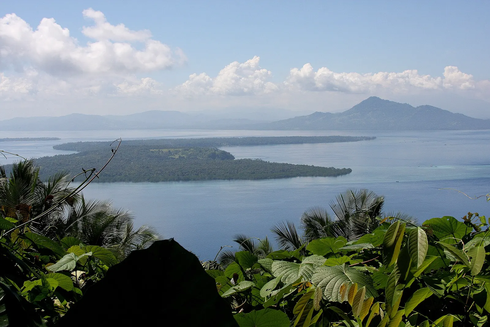
Bunaken National Park is a protected marine area off Manado in North Sulawesi, designated on 15 October 1991 at 89,065 ha and reset by a 2014 decree to 73,983.29 ha. It takes in five islands and stretches of mainland coast, in a northern and a southern section. UNESCO lists it only on the Tentative List, which is not World Heritage status.
When did Bunaken become a national park?
The legal date is 15 October 1991, when Forestry Minister decree 730/Kpts.-II/1991 designated the park. A second date, 21 December 1992, marks the day Indonesia's president inaugurated the park in Manado. Both appear in the profile kept by Indonesia's conservation directorate (KSDAE), and both are right: one is the decree, the other the ceremony.
Protection began earlier and more locally. The timeline below shows a provincial marine park a full decade before the national one, and a turning point in the 1980s that still shapes the place: a plan to move residents out met strong local opposition and was not carried out. People stayed, so this is a park with villages inside it rather than an empty reserve.
| Date | What happened | Reported by |
|---|---|---|
| 1975 | A group of divers makes the area's marine richness known, per one news article | Jurnal Flores |
| About 1978 | Bunaken becomes known as a tourist site while ornamental-fish work, marine park research and the development of Liang beach are under way | KSDAE |
| 1979 | Formal tourism begins, after the marine park research is published and a Dutch prince visits | KSDAE |
| 1980 | The provincial governor issues decree 224/1980 protecting the Manado marine park, covering Bunaken, Siladen and surroundings | KSDAE |
| 1980s | A plan to relocate residents is dropped after strong local opposition | KSDAE |
| 15 Oct 1991 | Designated a national park at 89,065 ha | KSDAE |
| 21 Dec 1992 | Inaugurated in Manado | KSDAE |
| 7 Feb 2005 | Submitted to the World Heritage Tentative List | UNESCO |
| 2014 | Decree SK.734/Menhut-II/2014 sets the area at 73,983.29 ha | KSDAE |
| 2019 to 2028 | Period of the current management plan | KSDAE |
How big is Bunaken National Park today?
Use 73,983.29 ha. That is the figure in the 2014 forestry decree, and the park booking portal repeats it. KSDAE's profile header shows 73,941.78 ha, about 41.5 ha below its own decree figure. For trip planning that gap means nothing. If you are citing the park in a report, the decree is the safer reference.
| Figure | Where it appears | How to read it |
|---|---|---|
| 89,065 ha | KSDAE, under the 1991 decree | The original designation |
| 890.65 km2 | Wikipedia | The same older total in other units; basis of the 97% marine share |
| 73,983.29 ha | KSDAE under the 2014 decree; park booking portal | The current legal figure |
| 73,941.78 ha | KSDAE profile header | A small official mismatch, unexplained on the figures alone |
Why do so many guides still say about 89,000 ha? The likeliest reason is ordinary repetition. It is the founding number, and reference text still leans on it: Wikipedia's split of 97% marine and 3% terrestrial is calculated on the older total. A guide quoting the larger figure is usually repeating 1991 rather than describing a different park. Treat the 97% as a fair picture of an overwhelmingly marine park, not a precise share of today's area. The totals alone do not show which boundaries moved, so do not read the drop as a map of waters lost or removed.
The portal spreads the area across four administrations: Manado, North Minahasa, Minahasa and South Minahasa. Indonesia's tourism ministry site places Bunaken Island itself in the Bay of Manado and within the city of Manado, which is why an island you reach by boat can carry a city address.
Which islands and coasts does the park include?
The park has two sections, and a trip to Bunaken Island touches only part of one. KSDAE's northern section covers Bunaken, Manado Tua, Siladen and the coast of Molas, Meras and Tongkaina, plus Mantehage, Nain and Tiwoho village. Its southern section covers the Tanjung Kalapa and Arakan-Wawontulap coasts on the mainland.
Wikipedia counts five islands. Wikivoyage adds Nain Kecil, so you may see a sixth name in some lists.
- Bunaken: the island most visitors mean when they say the name. Our guide to Bunaken Island covers it in detail.
- Manado Tua: an inactive volcano, and the sources disagree on its height. The UNESCO text says over 600 m and calls it the park's highest point; KSDAE says about 800 m, with protected forest near the summit. Wikipedia says it was once the capital of the Manado Kingdom, a 16th-century Christian kingdom with Portuguese and Spanish influences. See our Manado Tua island guide.
- Mantehage: relatively flat with extensive mangrove flats, partly separated by saltwater channels, per UNESCO.
- Nain: a dome-shaped island 139 m high, per UNESCO.
- Siladen: a low-lying coral sand island, per UNESCO.
On land and along the shore, the portal lists a mangrove information centre, a mangrove trail, a watchtower and the Tawara coral nursery. A listing does not confirm opening hours, so ask locally before you build a day around any of them. Access is by boat from Manado. Crossing times differ by source, and our Manado to Bunaken page sets them side by side. You can see the northern section on a Bunaken day trip from Manado, or compare beds under where to stay in Bunaken. The best time to visit Bunaken page compares the season claims.
Is Bunaken a UNESCO World Heritage Site?
No. Indonesia submitted Bunaken National Park to the World Heritage Tentative List on 7 February 2005 as a natural property under criteria vii to x. A Tentative List entry records what a country intends to put forward. It is not an inscription, and a page that gives Bunaken the full title is overstating its status.
There is a separate and more settled UNESCO link. The park lies in the core area of the Bunaken Tangkoko Minahasa Biosphere Reserve, which spans 746,405.92 ha and which UNESCO places in the heart of the Coral Triangle. A biosphere reserve belongs to a different UNESCO programme, so the two labels should not be merged.
Where does the name Bunaken come from?
One explanation is in print. Jurnal Flores, an Indonesian news site, says the name comes from the word Pamunakeng, meaning a stopping place for ships. The article cites no linguist or document, so treat it as a popular account. The neighbouring name has firmer backing: Wikipedia says Manado Tua means Old Manado, because the settlement moved to Sulawesi and took the name with it.
The same article says the area's marine richness only became known in 1975, through a group of divers. KSDAE's timeline above starts at about 1978, with ornamental-fish work, marine park research and the development of Liang beach. The two dates need not clash, since one describes divers and the other the beginning of tourism, but only the 1978 line comes from a government source.
Who lives inside the park?
Tens of thousands of people, though the counts differ. Wikipedia gives 22 villages and about 35,000 people. A published co-management paper says over 30,000. Wikivoyage gives both 20,000 and 30,000. KSDAE's number is 25 villages and urban wards, but that describes buffer zone communities, a different category, so it does not correct the 22.
Visitor numbers are older still. Wikipedia reports 32,000 to 39,000 visitors a year in 2003 to 2006, of whom 8,000 to 10,000 were international. Treat those as history, not as a current count.
Management rests within Indonesia's national park system under the forestry ministry, with a plan running from 2019 to 2028. The park also has a record of shared governance, covered on our Bunaken conservation page, along with the pressures on the reef. If you are looking for an official website, the booking portal and the KSDAE profile are the two government pages to use.
Why does the park matter for marine life?
UNESCO's text puts the sea between the park's islands at 200 to 1,840 m deep, and that depth sits close to shore because the area has no continental shelf.
Wikipedia gives about 390 coral species, from a reef assessment. For the wider species picture and what the numbers do and do not prove, read our Bunaken marine life guide. For how that geography becomes diving, see Bunaken diving, and for the reef flats above those walls, see Bunaken snorkeling.
What does the park charge visitors?
The official entry rows sit in the price table on this page, and they use different units for Indonesian and foreign visitors. Sources disagree about how the foreign charge applies, so the argument has its own page: the Bunaken entrance fee explained.
What else do people ask about the park?
Who manages Bunaken National Park?
It sits in Indonesia's national conservation system under the forestry ministry, whose conservation directorate publishes the park profile and a management plan running from 2019 to 2028. Published accounts also describe a local advisory board with a co-management role, though those accounts are historic.
Where is Bunaken National Park located?
In North Sulawesi, around Manado. Bunaken Island lies in the Bay of Manado, while the park's southern section follows the Tanjung Kalapa and Arakan-Wawontulap coasts on the mainland.
How do you get to Bunaken National Park?
By boat from Manado. The park portal gives about 60 minutes by motorboat to Bunaken and about 90 minutes to Mantehage or Manado Tua. Other sources give different crossing times.
Is Bunaken a UNESCO site?
Only in a limited sense. The park is on the World Heritage Tentative List and forms the core of a UNESCO biosphere reserve, but a Tentative List entry is not an inscription.
Why do some guides say the park is about 89,000 ha?
That is the 1991 designation figure of 89,065 ha. A 2014 decree set the area at 73,983.29 ha, which is the figure the park booking portal uses.
Which prices are published?
Official fees and public third-party listings, each with its source and date. These are not our prices or offers. Fees and fares change, and sources sometimes disagree, so check the source before you rely on a figure.
| Item | Published price | Source | Checked |
|---|---|---|---|
| Bunaken National Park entry, foreign visitor, per person per visit (park booking portal) | IDR 150,000 | ayoketamannasional.kehutanan.go.id | Nov 2026 |
| Bunaken National Park entry, Indonesian visitor, per person per day (park booking portal) | IDR 10,000 | ayoketamannasional.kehutanan.go.id | Nov 2026 |
Which sources support this page?
- KSDAE park profile (decrees, sections, history)
- Park booking portal
- Wikipedia: Bunaken National Park
- Indonesia tourism ministry: Manado and Bunaken
- UNESCO World Heritage Tentative List, Ref. 2002
- Wikipedia: Manado Tua
- UNESCO Bunaken Tangkoko Minahasa Biosphere Reserve
- Co-management paper on Bunaken (PDF)
- Wikivoyage: Bunaken
- Jurnal Flores: Taman Nasional Bunaken
How do I reach the desk?
Questions about the park, or a correction to a decree date or area figure on this page, can go to WhatsApp +62 811-3941-4563 or bd@juaraholding.com. The desk replies as a travel guide's request desk. It does not speak for the park authority.
Send the desk your dates, group size, and dive level. The desk replies in writing.
Ask the desk on WhatsApp bd@juaraholding.com