On this page
By Bunaken Island Editorial Desk
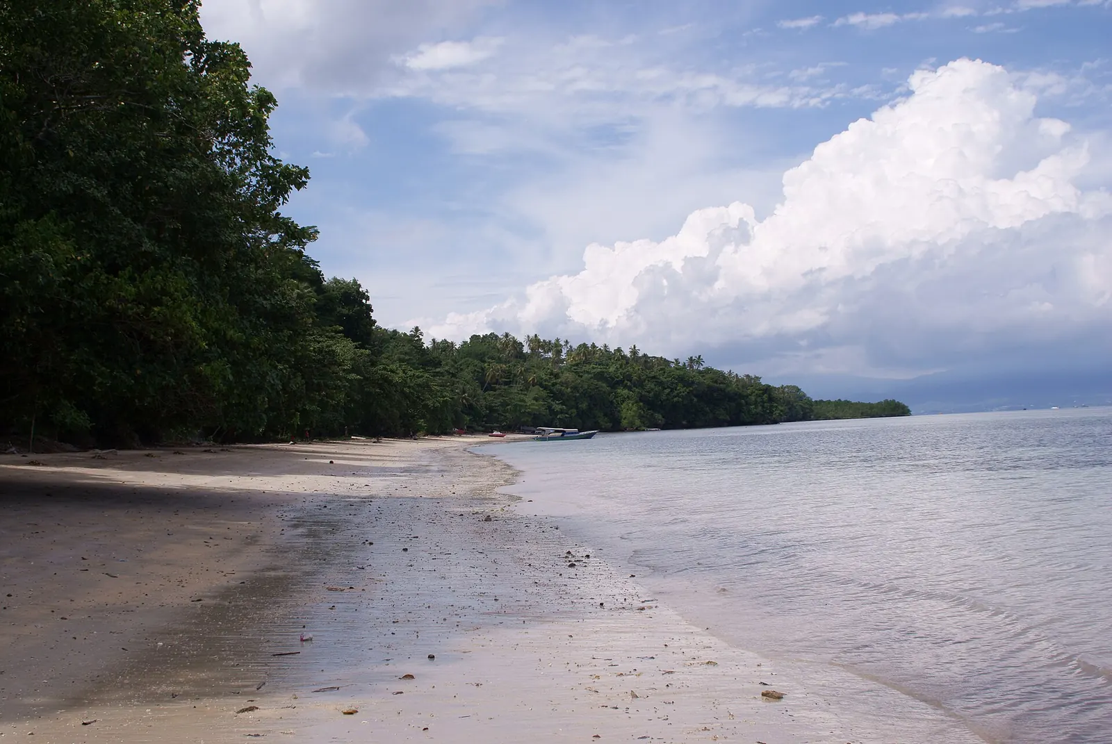
Liang Beach, Bunaken, is the shore of Liang Bay. Dive The World links Liang Bay to the south side, which it calls usually calm on the surface. The portal lists Pantai Liang as a ticket point. Wikivoyage describes coarse yellow sand on the south and west and warns that the beach may disappear at high tide. Choose by sea and tide, not by photographs.
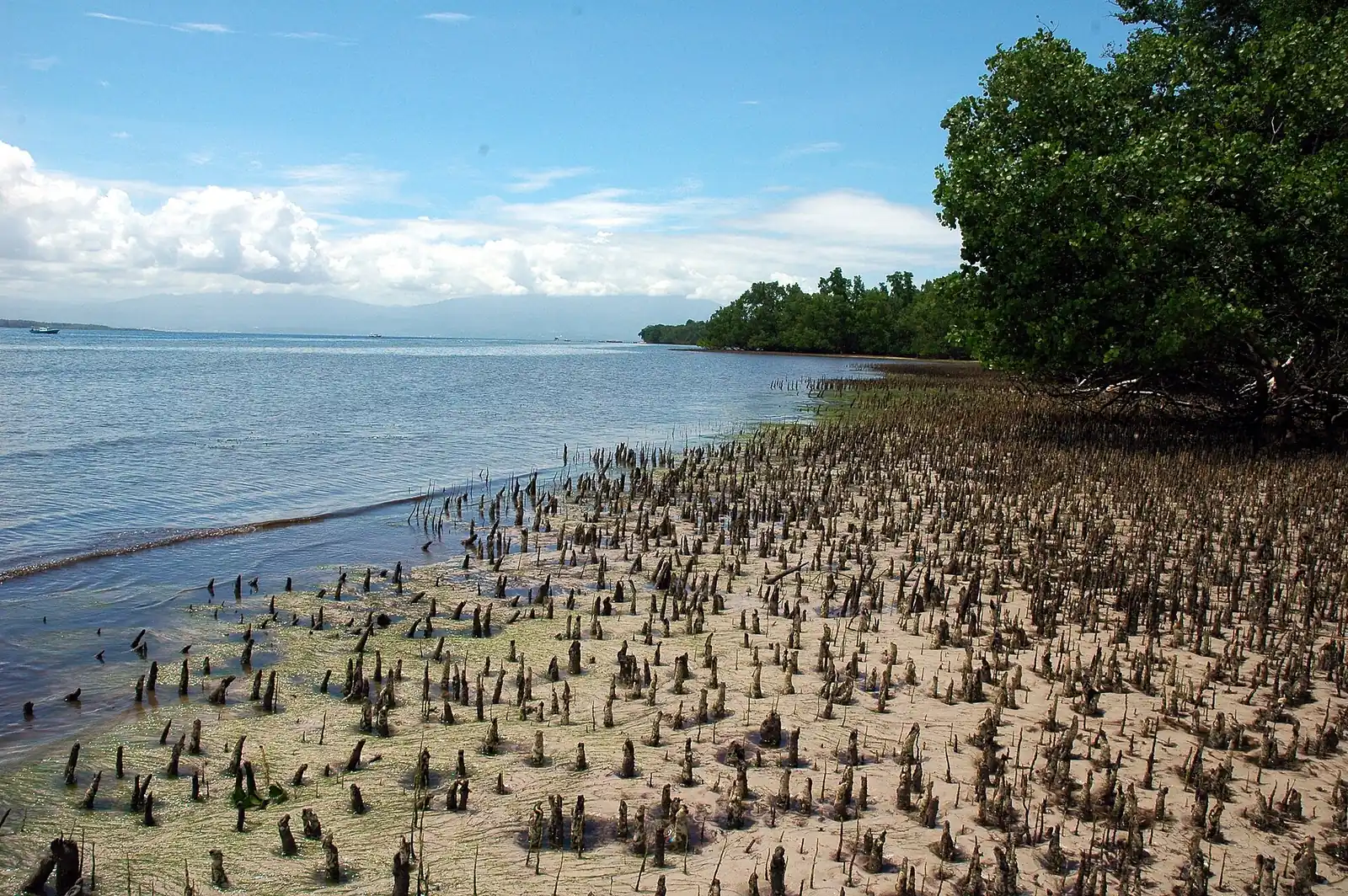
Where is Liang Beach on Bunaken?
Published descriptions place it loosely, but the pieces fit together. Indonesia's tourism ministry site gives Bunaken an area of 8.08 km². Wikipedia describes the island as crescent-shaped, with its south side at the heart of the park. Dive The World, a dive travel company, calls Liang Bay a favoured place for villagers to relax, and in the same passage it says the island's curve keeps the south side usually calm on the surface. We read that as placing Liang on the sheltered inner curve. Use a current map to confirm the exact spot before you pick a room on the strength of it.
The name also has an official use. The park booking portal lists Pantai Liang ("Liang Beach") as one of three ticket points, along with Dermaga Baru-Bunaken Timur and Mainland Gate. That makes it a place to pay, and it says nothing about landing there: Sulawesi.com, a publisher that also sells tours, says the public boat lands at Bunaken village.
It also has history. Indonesia's conservation directorate says Bunaken has been known as a tourist site since about 1978, when the development of Liang beach was under way alongside ornamental-fish work and marine park research. So Liang has been part of the visitor story from the start.
How does Liang differ from Pangalisang?
The two names sit on different stretches of shore, and they lead to different kinds of day. Pangalisang's location comes from two operators. Siladen Resort names Pangalisang as one section of the east face, which it describes as one long wall split into Bunaken Timur I, Pangalisang, Bunaken Timur II and Cha-Cha, with usually mild currents. Two Fish Divers advertises a resort on Pangalisang Beach with a maximum of 24 divers and no more than 4 divers per guide.
| Shore | What the shoreline is like | Water in front | Who says so |
|---|---|---|---|
| Liang and the south | Resorts on coarse yellow sand; a local place to relax at Liang Bay | Usually calm on the surface | Wikivoyage; Dive The World |
| West | Resorts on coarse yellow sand | Not stated | Wikivoyage |
| Pangalisang and the east | A mix of mangroves and small beaches | A wall with usually mild currents | Wikivoyage; Siladen Resort |
| Main village | A sandy beach | Strong snorkelling, per Wikivoyage | Wikivoyage |
Those shore types come from a single source, Wikivoyage, and they are broad brush. Still, they suggest a clear division. If you picture sand in front of your room, the south and west are the closer match. If you care more about being near the east wall, Pangalisang fits better, as long as you accept that mangroves are part of the view. The useful comparison is between kinds of shoreline, and our guide to where to stay on Bunaken takes the choice further.
The names also change depending on who is writing. "Pangalisang" is a dive site to one operator and a beach address to another, so when a property uses the name, ask how far the room is from the water and from that stretch of reef.
Is the beach there at high tide?
Not always. Wikivoyage warns that the beach may disappear at high tide. The warning is general and is not specific to Liang, so it should shape your expectations for any shore on the island. Ask a property to tell you honestly how much sand remains at high water and, if you can, ask for a photograph taken at that state of the tide.
Low tide brings a different limit. Wikivoyage warns snorkellers not to walk on corals when returning at low tide, and it suggests a kayak as the safest way to reach spots. Put those two warnings together and the tide narrows your beach day from both ends:
- High water: the sand may be gone, so a towel-and-book afternoon may not work.
- Low water: the reef flat may be exposed or very shallow, so getting in and out for a swim becomes awkward and can damage coral.
Check a tide table for your dates, or ask your host for the times each morning. Wikivoyage advises fins and a reference point for the swim out. Our Bunaken snorkeling guide sets out the questions on tide and current. Ask your host or a boat crew when and where swimming is advisable that day.
Can you walk between areas?
Partly, and less easily than the small map suggests. Wikivoyage says pathways connect the settlements, that many are impassable after rain, and that ojeks serve the island. Its picture is one of informal tracks, not a coastal promenade. The high-tide warning applies here as well, because a beach that disappears cannot be walked at that hour.
The middle of the island also rises. The UNESCO text puts a plateau of about 50 m across the west and centre, and the highest point at 71 m. Ask your host about the route before setting out.
A few practical rules follow from all this. Our advice: walk in the morning and in dry spells. Carry water. If you plan an evening meal in another settlement, arrange the ride back first. And if you land by public boat at the village with bags, ask your host about the last leg before you arrive, since the walk along the shore may not be an option.
What is at Liang today?
Liang is one of several shores on Bunaken Island. Remote + Afloat, a travel blog written in 2018, describes a market opposite the pier with food and souvenir stalls aimed at day trippers from Manado, and the Bunaken National Park office calls the island a centre for souvenirs sold by residents.
Four things are reported, and they vary in age, so read each with its date in mind.
- A park ticket point. The official portal lists Pantai Liang now, which makes this the most current item.
- A Visitors Centre. Wikivoyage says a Visitors Centre on Liang Beach sells handicrafts and souvenirs. The line carries no date, so do not plan a shopping stop around it.
- Local visitors. Dive The World's description of Liang Bay as a place where villagers relax is also undated.
- Resorts. Wikivoyage places resorts along the south and west, but businesses here open, close and rename themselves, so check each property directly and ask when its photographs were taken.
For travellers who will not dive, treat Liang as a place to spend a few hours when the tide suits, not as a destination with a line of facilities. Our page on Bunaken for non-divers suggests how to fill the rest of your time on land and on the water.
What else do people ask about Bunaken's beaches?
What is Liang Beach like?
Dive The World calls Liang Bay a favoured place for villagers to relax, on a side of the island that is usually calm on the surface. Wikivoyage describes coarse yellow sand on the south and west and warns the beach may disappear at high tide.
Which beach should you stay on at Bunaken?
Choose by what you want from the shore. Wikivoyage suggests the south and west for coarse sand, and the east for mangroves and small beaches beside the wall. The main village has a sandy beach and a strong snorkelling reputation.
Does Bunaken have good beaches?
That depends on your idea of a beach. The sources on this page offer no neutral ranking. Sand is coarse in places, and Wikivoyage warns it may vanish at high tide, so swimming and sunbathing depend on the state of the tide.
Can you watch the sunset on Bunaken?
Two travel blogs name spots. Remote + Afloat says Liang Beach, with the sun going down over Manado Tua, and Travelnania points to the south-west coast by the main village. Ask your host which spot has a clear view at that time of year.
Liang Beach or Pangalisang: which is better for diving?
Neither is a clear winner on the evidence. Siladen Resort says the east face at Pangalisang has usually mild currents, and Dive The World says the south side is usually calm on the surface. Ask each operator which sites its boats reach from that shore.
Which sources support this page?
- Indonesia's tourism ministry site: Manado and Bunaken
- Wikipedia: Bunaken
- Dive The World: Manado and Bunaken dive sites
- Park booking portal: Bunaken National Park
- Sulawesi.com: the Manado to Bunaken boat question (publisher that also sells tours)
- KSDAE, Indonesia's conservation directorate: Bunaken National Park profile
- Siladen Resort: dive sites map
- Two Fish Divers: Bunaken Island, Manado
- Wikivoyage: Bunaken
- UNESCO World Heritage Centre: Tentative List entry, Bunaken National Park
- Remote + Afloat: Bunaken National Park travel guide
- Bunaken National Park office: Pulau Bunaken
- Travelnania: things to do in Bunaken
How do I reach the desk?
Unsure which shore fits your trip? Ask on WhatsApp at +62 811-3941-4563 or at bd@juaraholding.com. The desk owns no rooms, and an enquiry can become a paid booking, which is why we disclose a commercial interest in the disclaimer. Nothing is agreed until you have a written offer.
Send the desk your dates, group size, and dive level. The desk replies in writing.
Ask the desk on WhatsApp bd@juaraholding.com